
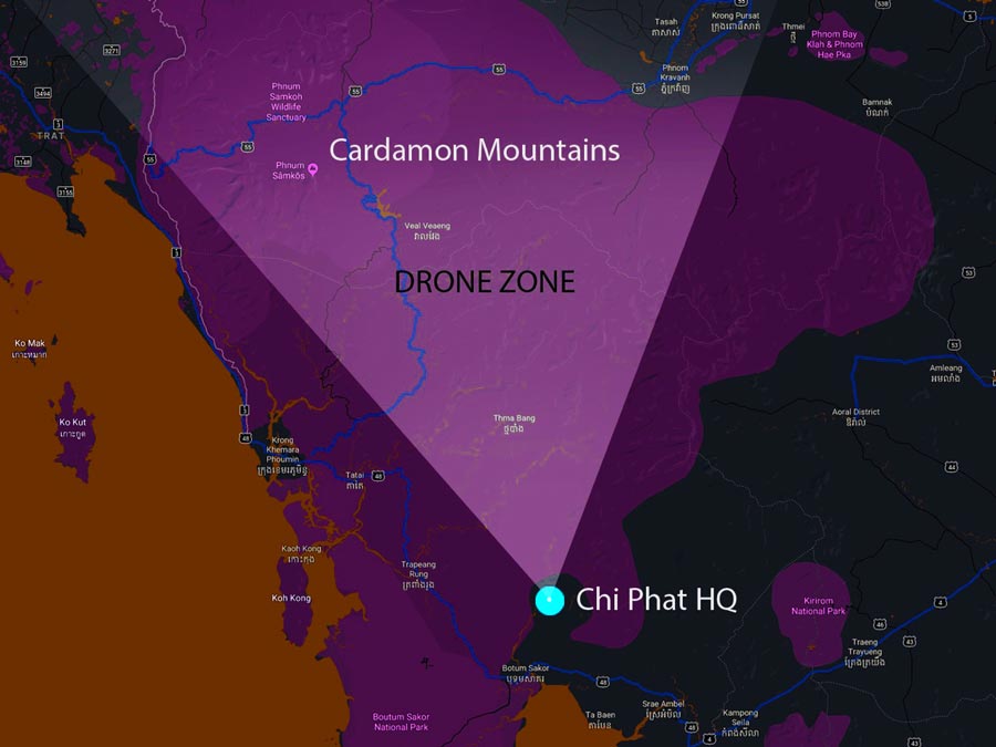
By using drones with thermal imaging cameras we help locate illegal logging and animal trapping activities within the Cardamon mountain rain forests, in Cambodia. This new approach in conjunction with ranger patrols, will combat the illegal wildlife and logging trade.
Our goal
We protect wildlife from illegal activities with the help of drone technology
Where we start
Our pilot project
This initial research project will be implemented as a first in the Cardamon mountain rain forest, Cambodia.
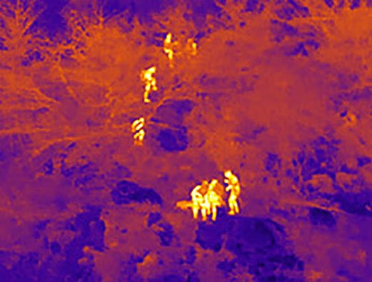
On night and day patrols, our first response drone will help to locate and pin point illegal human activities using video, thermal imagery and GPS data. The drone is easily transported in a backpack for quick set up and take-off capabilities.
We see this pilot scheme as a stepping stone to having drones for each of the seven ranger patrol stations within the national park.


Where we start
The area
South East Asia is at the epicentre of the global extinction crisis and the majority of the region’s protected areas are ‘paper parks’ with insufficient resources, capacity, or supervision to achieve effective species conservation.
80% of illegal activity within the forests occurrs at night. Implementing the use of a thermal vision camera mounted on a drone will locate the heat of chain saws, motor bike engines and human activity within the forest.
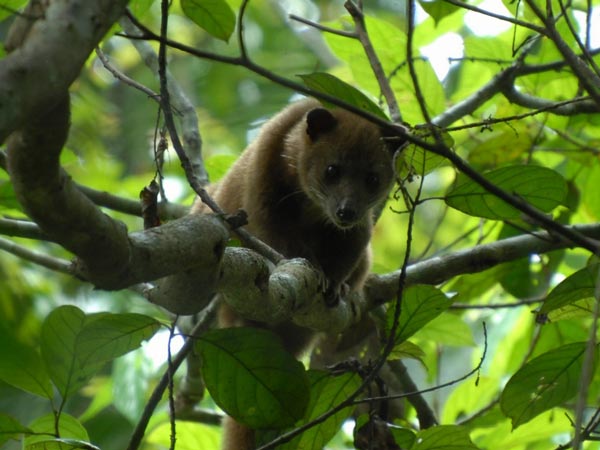
Cambodias wildlife is under constant and increasing threat. This project could save many of them. We need to take action now to protect animals from snares and captivity, along with trees being felled at an alarming rate.
Technology used
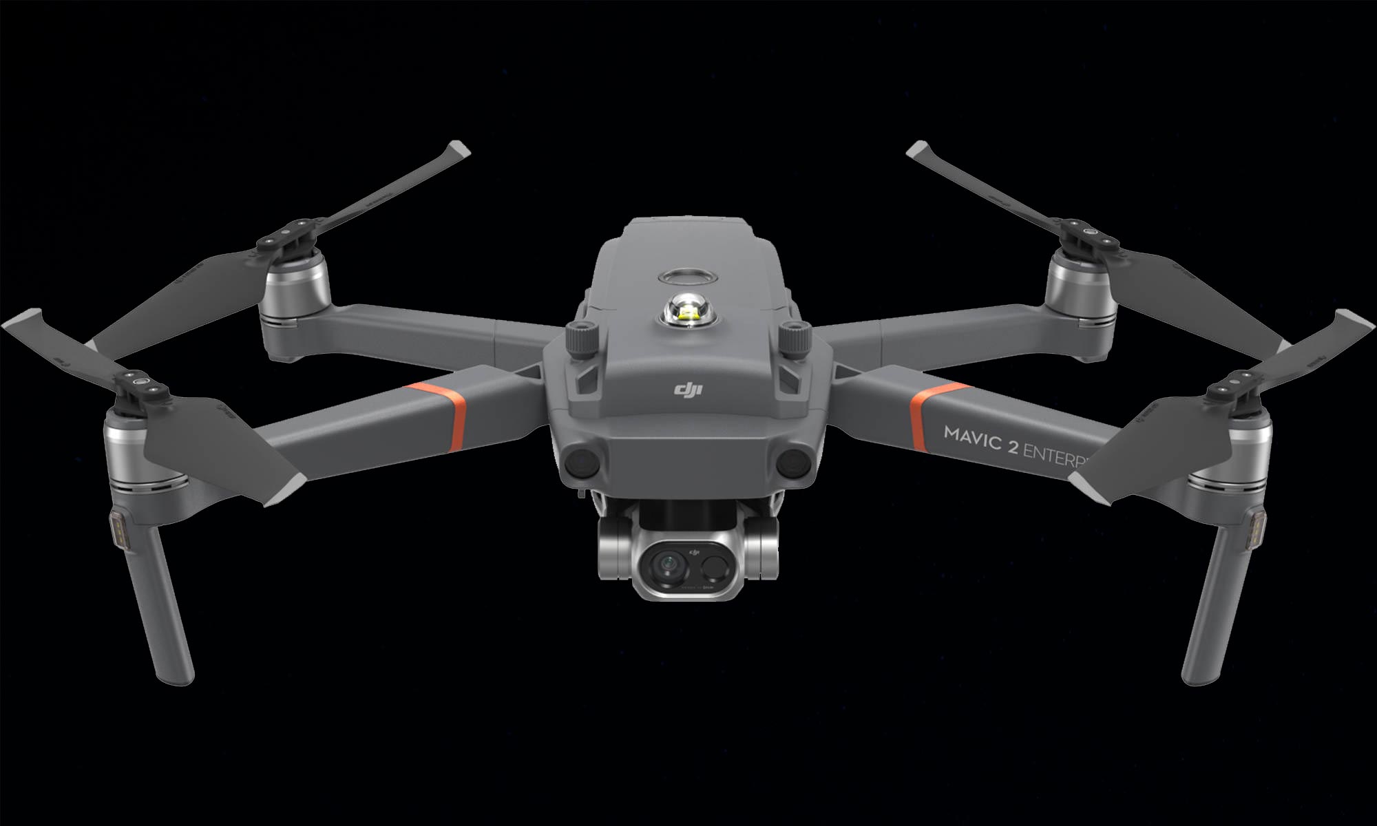
The Mavic pro 2 Enterprise Dual
Cameras
The Mavic 2 enterprise dual features a three-axis gimbal-stabilized camera housing a side-by-side 4K sensor for capturing visible light and a FLIR Lepton® thermal microcamera for capturing thermal data. Together these sensors allow pilots to perform flights at night, as well as fly in complex daytime conditions like fog and smoke.
Spotlights
A dual spotlight with a brightness of 2,400 lumens aids operators in carrying out missions in dark or low-light areas.
Speaker
A loudspeaker with a maximum projection of 100 decibels (1-meter distance) lets pilots play up to 10 custom voice recordings on-demand, providing a communications channel to nearby individuals that can be alerted by ranger operations.
GPS Time-stamping
Encodes the time, date, and location of every recorded image taken by the visual camera
Obstacle avoidance sensors
31 minutes max flight time and a top speed of 72 kph (45 mph) Flies up to 7km
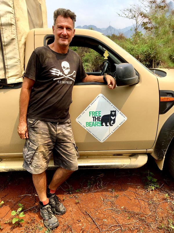
Ian Wallis
About the founder of this project
Australian based Ian Wallis first volunteered with Free The Bears (FTB) back in 2005 where he spent a month at the Phnom Tamao Wildlife Rescue Centre (PTWRC), 70Km south of Phnom Penh Cambodia.
Ever since his endless passion for protecting animals and wildlife sees him being involved in many awareness and fundraising campaigns and activities, some of them listed below:
- running half marathons in a bear and tiger suit in Angkor Wat for charity raising funds and raising awareness of the plight of bears and other animals in captivity (with FTB)
- joining bear rescues missions and being involved on many levels at the centre with FTB
- volunteering at Cat Tien Bear Rescue Centre (FTB) in Vietnam and their new bear sanctuary in Luang Prabang, Laos
- spending time at the Elephant Valley Project in Mondulkiri, Cambodia
- sponsoring bears, clouded leopards and ranger-patrols in the Cardamom mountains
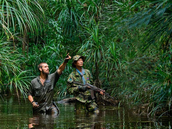
- patrolling with the rangers on the 4-6 days through the jungle; gathering hundreds of snares and looking for signs of illegal activities
PROJECT DETAILS
PROJECT
GOALS
- Locate trapped or snared animals within the forest; rescue and returned to the wild; or rehabilitation at the wildlife care centre
- Locate illegal activity within forest and use GPS co-ordinates to pass onto rangers for a successful arrest of animal poachers and illegal loggers resulting in habitat loss
- Added protection for forest animals and deterrent of illegal activity
PROJECT
STRUCTURE
- Join rangers forest patrols using drone for surveillance and location of illegal logging and habitat loss activities in daylight using GPS
- Use drone for night flight surveillance of illegal animal trapping, trapped or snared animals and any illegal human activity within the protected areas using GPS
- Reports supplied after each patrol and final report will be shared with partners and sponsors
- Estimated 3 week duration for pilot scheme
Project Partner
World Animal Protection
(formerly WSPA Australia Limited)